

 Aerospace & Defence
  Agriculture
  Automotive
  Building & Construction
  Chemicals
  Digital Technologies
  Energy & Power
  Equipment & Machinery
  FMCG
FMCG  Hospitality & Tourism
  Metallurgy
  Oil & Gas
  Retail Businesses
  Materials
  Banking & Financial Services
  Electronics & Semiconductors
  Healthcare & Pharmaceutical
  Packaging




Market Overview
According to Novatrends Market Intelligence, the Global Survey Equipment Market was valued at USD 8.84 billion in 2025 and is anticipated to propel at a growth rate of 7.6% from 2026-2036.
The survey equipment market provides total station survey equipment, GNSS surveying equipment, 3D laser scanner survey (terrestrial laser scanner), UAV survey equipment (survey drone equipment), and digital level survey instruments for precise position, angle, distance, and elevation measurement in land surveying, construction surveying, hydrographic surveying, mining surveying, and topographic mapping applications. Total station survey equipment combines electronic theodolite angle measurement with electromagnetic distance measurement (EDM) in a single instrument for precise 3D coordinate determination of survey points. Robotic total station automates target tracking and measurement acquisition, enabling one-person survey operation where the total station tracks a prism-equipped rod person for machine control and stake-out applications. GNSS surveying equipment (GPS/RTK receiver) uses satellite positioning for rapid high-accuracy (centimeter-level) position determination in land surveying and construction layout, with RTK GNSS survey (real-time kinematic) providing centimeter-level accuracy with sub-second latency using base station or network RTK correction. LiDAR survey equipment (terrestrial LiDAR scanner, airborne LiDAR) provides dense 3D point cloud data for topographic mapping, infrastructure inspection, and construction as-built verification.
Market Dynamics
The market is driven by global infrastructure construction investment (roads, bridges, buildings, pipelines) creating construction survey equipment demand for machine control GNSS and robotic total station, digital transformation of surveying workflows from conventional total station to UAV survey equipment and LiDAR survey equipment for faster, safer, and more comprehensive site data collection, and mining industry capital investment requiring ruggedized mining survey equipment for production blasting, deformation monitoring, and pit survey programs. RTK GNSS survey network infrastructure expansion (Trimble RTX, Leica SmartNet) is enabling sub-centimeter accuracy GNSS surveying equipment without individual base stations. UAV survey equipment market growth is accelerating with drone regulation liberalization enabling beyond-visual-line-of-sight (BVLOS) commercial survey drone equipment operations. 3D laser scanner survey adoption is growing in infrastructure inspection, heritage documentation, and construction BIM integration. Trimble survey equipment and Leica Geosystems survey equipment maintain technology leadership in robotic total station and RTK GNSS surveying equipment with comprehensive software ecosystems (Trimble Business Center, Leica Infinity). Survey equipment market growth is supported by global infrastructure spending programs. Topcon survey equipment is growing market share with competitive total station and GNSS product pricing. Digital level survey replacement with RTK GNSS survey is reducing traditional leveling instrument demand. Hydrographic survey equipment demand is growing with port deepening and offshore wind farm site investigation programs. Survey equipment market trends show growing UAV survey equipment, LiDAR survey equipment, and mobile mapping survey adoption in construction and infrastructure programs globally. In January 2024, Trimble expanded Trimble survey equipment and RTK GNSS survey with SX12 scanning total station and R12i GNSS receiver innovations, while Leica Geosystems advanced Leica Geosystems survey equipment and 3D laser scanner survey with BLK360 and TS16 innovations. Survey equipment market trends show accelerating digital surveying transformation with UAV survey equipment and LiDAR survey equipment globally through 2036.
Segment Analysis
By Type: Total Station Survey Equipment holds the largest share of the Survey Equipment market, supported by strong adoption and well-established supply chains across key end-use industries. GNSS Surveying Equipment is the fastest-growing segment, propelled by rising investments and expanding application scope in high-growth sectors.
By Application: Land Surveying holds the largest share of the Survey Equipment market, supported by strong adoption and well-established supply chains across key end-use industries. Construction Surveying is the fastest-growing segment, propelled by rising investments and expanding application scope in high-growth sectors.
By End-Use: Construction holds the largest share of the Survey Equipment market, supported by strong adoption and well-established supply chains across key end-use industries. Mining is the fastest-growing segment, propelled by rising investments and expanding application scope in high-growth sectors.
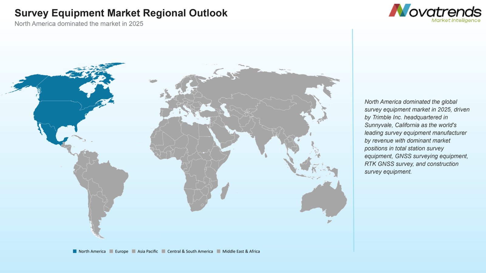
Recent Developments in Survey Equipment Market
- In January 2024, Trimble Inc. (USA) expanded Trimble survey equipment and RTK GNSS survey with SX12 scanning total station, R12i GNSS surveying equipment, and UAV survey equipment integration, advancing construction survey equipment, robotic total station, and LiDAR survey equipment for construction and infrastructure survey equipment market growth programs globally.
- In April 2024, Leica Geosystems AG (Hexagon AB) advanced Leica Geosystems survey equipment and 3D laser scanner survey with BLK2GO mobile LiDAR survey equipment and TS16 robotic total station innovations, expanding RTK GNSS survey, construction survey equipment, and survey equipment market growth for BIM integration and hydrographic survey equipment programs globally.
- In July 2024, Topcon Corporation (Japan) expanded Topcon survey equipment and total station survey equipment with Topcon GT series robotic total station and Topcon HiPer HR RTK GNSS survey innovations, advancing construction survey equipment, mining survey equipment, and digital level survey for construction and infrastructure survey equipment market growth programs globally.
- In September 2024, DJI Enterprise (China) advanced UAV survey equipment and survey drone equipment with DJI Zenmuse L2 LiDAR survey equipment and Phantom RTK GNSS photogrammetry innovations, expanding 3D laser scanner survey alternatives, topographic surveying, and land surveying equipment for survey equipment market trends in construction, mining, and infrastructure programs globally.
- In December 2024, Sokkia (Topcon Group) expanded total station survey equipment and digital level survey with Sokkia iX-1000 robotic total station and SDL series digital level survey innovations, advancing construction survey equipment, mining survey equipment, and GNSS surveying equipment for Asian and global survey equipment market growth programs globally.
- In March 2025, FARO Technologies Inc. (USA) advanced 3D laser scanner survey and LiDAR survey equipment with FARO Focus Laser Scanner and ScanArm innovations, expanding construction survey equipment, hydrographic survey equipment alternatives, and survey equipment market trends with mobile LiDAR survey equipment for AEC, industrial, and public sector survey equipment market programs globally.
Top Survey Equipment Market - Key Market Players
- Trimble Inc.
- Leica Geosystems (Hexagon AB)
- Topcon Corporation
- DJI Enterprise
- Sokkia (Topcon Group)
- FARO Technologies Inc.
- Nikon-Trimble Co. Ltd.
- Pentax Precision (Ricoh)
- South Surveying & Mapping Instrument (China)
- CHC Navigation (China Hi-Target)
- Spectra Geospatial (Trimble)
- GeoMax AG (Hexagon)
- NavVis GmbH (Germany)
- Riegl Laser Measurement Systems
- Velodyne Lidar (Ouster)
Global Survey Equipment Market Report- Scope (Customizable)
Scope | Description |
Historic Period | 2021-2024 |
Base Year (Esti.) | 2025 |
Forecast Period (F) | 2026-2036 |
Market Values | USD Billion |
By Type | Total Station Survey Equipment, GNSS Surveying Equipment, 3D Laser Scanner Survey, UAV Survey Equipment, Digital Level Survey |
By Application | Land Surveying, Construction Surveying, Hydrographic Surveying, Mining Surveying, Topographic Surveying |
By End-Use | Construction, Mining, Oil and Gas, Infrastructure, Government |
Market by Region | North America (NA), Europe (EUR), Asia Pacific (APAC), Central & South America (CSA), and Middle East & Africa (MEA) |
Countries Covered | U.S., Canada, and Mexico; Germany, France, UK, Russia, Italy, Spain, and Netherlands; China, India, Japan, South Korea, and Australia; Brazil, Argentina; Saudi Arabia, UAE, Turkey, Egypt, and South Africa |
Detailed Market Segmentation
- By Type (Revenue in USD Million)
- Total Station Survey Equipment
- GNSS Surveying Equipment
- 3D Laser Scanner Survey
- UAV Survey Equipment
- Digital Level Survey
- By Application (Revenue in USD Million)
- Land Surveying
- Construction Surveying
- Hydrographic Surveying
- Mining Surveying
- Topographic Surveying
- By End-Use (Revenue in USD Million)
- Construction
- Mining
- Oil and Gas
- Infrastructure
- Government
- By Region (Revenue in USD Million)
- North America
- U.S.
- Canada
- Mexico
- Europe
- Germany
- France
- UK
- Russia
- Italy
- Spain
- Netherlands
- Asia Pacific
- China
- India
- Japan
- South Korea
- Australia
- Central & South America
- Brazil
- Argentina
- Middle East and Africa
- Saudi Arabia
- UAE
- Turkey
- Egypt
- South Africa
- North America
 GET A FREE SAMPLE
 Need a custom report?